 (Volcanic plug and yellow flower).
[Edit--Note that recent construction in the Inspirada development has changed access to Sloan Canyon. Use the information in this linked post, along with what is written below, for more recent directions to the trailhead].
Hiked Saturday, March 23.
This is the petroglyph hike. It should go without saying (but I'll say it, anyway): DO NOT TOUCH THE PETROGLYPHS. You shouldn't go crawling on those rocks, at all. It's ancient art, and you wouldn't go crawling all over an art museum, would you? In particular, the oils in your hands may speed the erosion of the desert varnish that makes these petroglyphs possible.
I tried to find this trail way back on February 16, as my Hike 2013.008. However, the directions in the book I was using were pretty useless ; it told me to drive "several miles" along a rough dirt road, looking for a power line pole with a number that was in an entirely different format from the ones in the field.
 (Looking north from the "parking lot." The concrete wash passes beneath this spot. A large detention basin is behind the concrete structure in the distance).
The BLM also gives directions to this trailhead. My suggestion would be to ignore those directions, unless you just happen to have a high-clearance 4-wheel drive vehicle and you want to test its capabilities for longer and farther than necessary. Instead, I more or less followed this route, one of many places where an alternate, north or east approach (as opposed to the BLM's west approach) is described.
 (Looking west from the "parking lot." You start by walking along the service road, which is just to the left of this row of transmission towers).
From St. Rose Parkway (NV-146), head south on Executive Airport Drive. There's a light there. It's about 2 1/2 miles northeast of I-15, and about 2 miles northeast of Las Vegas Blvd. It's also about 1 1/2 miles southwest of Eastern Avenue. After about 1 1/2 miles, you'll pass Volunteer Blvd, where there's a traffic signal. Continue south. Executive Airport Drive is now Via Inspirada. After another 1 1/2 mile or so, the speed limit drops to 15mph, and the road makes a sharp left-turn, and is now Bicentennial Parkway.
 (Looking nouth from the "parking lot." The dirt road I took to get here runs just right of the concrete wash you see in front of you).
Hopefully, there's no one following you, because you'll need to slow down and get ready to pull off the pavement, on your right. As soon as you pass over a wash, that's your turn.
 (The small sign at the beginning of the Sloan Canyon Access Road, which intersects with the service road, just 1/4 mile west of where you started).
This is NOT Via Contessa. On Google Maps, this is shown as a dirt road just east of Via Contessa, and runs parallel to and just east of the concrete wash. The dirt road parallels the wash for about 200 feet before making a sweeping left turn. You head that way a bit more than 1000 feet before turning south, again. It drops into a small gully as it does so.
 (Boundary of Sloan Canyon National Conservation Area).
This is the only area of the dirt road where you'd need to slow to a crawl. Anything without an exceptionally long wheelbase or low clearance should be able to make it through. The rest of the dirt road is otherwise very flat, and cruising along at 25 - 30 mph seemed pretty safe.
 (High wall on the east side of Sloan Canyon, somewhat after passing the first junction with Trail 200, but before the second barrier).
After clearing the gully, you climb up the other side, then begin a turn to the left, back along the concrete wash. Parallel it for about 1600 feet, then slow and make a right. Exactly where the road crosses the wash is a spot that seems to be a good parking spot, at least if you're in a sedan. Don't block any of the gates, of course.
 (Petroglyph of desert bighorn, which seems to appear in every desert petroglyph grouping I've ever visited).
People with high clearance vehicles can continue on, making a slight right for an easier approach up the very slight incline, then a left, then another right. The road is rougher there, but, at least when I went, it would not be an issue for 2-wheel drive, high-clearance vehicles.
 (Extra-terrestrial humanoid?)
Whether driving or walking, you'll need to head west about 1/4 mile, paralleling the brown towers that hold high voltage transmission wires.
 (Rubber-armed humanoid or gecko).
After 1/4 mile (and just before you'd reach the powerline with the alleged 2084 number on it), there was a stake with a small sign that indicated the way to Sloan Canyon. This is labeled Sloan Canyon Access Road on Google Maps. If you look towards where this road heads, you'll see it's the first narrow canyon you encounter from the east. This canyon broadens before you, and drops down to join the broad wash that empties into the the detention basin that's just a little upstream of where you (or, at least, I) parked.
 (Millipede and gecko or stick human figure).
Follow Sloan Canyon Access Road to the north. You'll pass a sign announcing the boundary to Sloan Canyon National Conservation Area in about 1/2 mile. After another 1/2 mile, you'll reach a very small parking area, and a fence that would keep you from driving any further.
 (More rocks with desert varnish, and some petroglyphs).
During my walk from the wash to the parking area, two pickup trucks passed me. On the way out, one ATV and one SUV came in. It's unlikely that anyone else visited the site during the 3 hours or so I was walking in the area, and this was on a Saturday (albeit a March Madness Saturday, so maybe everyone was watching basketball). ;D
 (Yellow flowers. Saw a lot of these guys. The flower looks like a poppy, but the plant leaves do not).
The display at the trail head is probably not going to tell you anything you don't already know. There's also a place to sign in, so if you plan on getting lost, be sure to sign in so they'll know where to look for you.
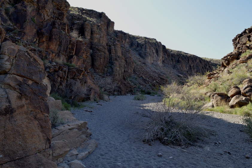
From the parking trail head, continue up the main wash. This is Trail 100. It's the base of a wash, so the going may be a bit slower than you were enjoying on the dirt road. The canyon walls that began narrowing along your walk up to the canyon mouth get even narrower and taller as the wash winds through the canyon.
 (Fiddleneck).
Three-quarters of a mile after the the trail started, there was a stake in the middle of the wash. To the left was the continuation of Trail 100. To the right was labeled Trail 200. Since Trail 100 sounded like the main way to me, and that way was clearly wider, and the hikers in front of me went that way, I went that way, too.
 (Small purple flowers--couldn't id them, either).
Trail 100 was smooth and flat for the next 1/4 mile or so. Then there's a 1/4 segment with a series of "barriers," places where you could not just walk up the sandy wash bottom. The first one had a very obvious trail that headed along the left side of the wash, and was an easy walk up. The second one didn't even leave an impression on me, so I'm assuming it was also a walk-up. The third one, however, is Class 3. It's not a particularly difficult Class 3, and it's a very short segment--one short climb, where you'll either need enough upper body strength to pull yourself up, or someone giving you a boost to your foot to get over some very slick rock.
 (Globe mallow).
The description I linked above says you should go up the middle of the barrier, where if you fall, you'll just land on the sand. However, I think most people go up the left side, where there's a lot more rock to grab on to.
After the third barrier, the trail bends to the left and widens, again. The left side is steeper and has a sort of onion peel vibe to it. The right side has large volcanic blocks with lots of desert varnish, and that's where the petroglyphs are located.
 (Looking southeast from near the north end of Trail 200. Orange are mallow. Yellows are those poppy-looking flowers).
The petroglyphs continue for another 1/10th to 1/8th of a mile, thicker in some places than others. I stayed on the wash floor because I didn't want to damage the ancient rock art. This is suggested for all.
After the petroglypths petered out, I continued exploring a bit further. Coming around a bend, I saw a huge, tall volcanic plug in the distance. Very cool.
Within an additional 1/8th of mile, I encountered another stake in the ground. This one pointed me in three directions: Trail 100 was the way I came, Trail 200 (also labeled "Cowboy Trail" on Google Maps) was up and to the right, and Trail 300 was straight ahead.
 (More fiddleneck).
Since I already knew that Trail 200 intersected with Trail 100 in the direction I had just come from, I went up towards Trail 200. This area had a nice little patch of color. Desert poppies were blooming relatively thickly (for this area, I would presume). Desert mallow were mixed in, as were tiny purple flowers I need to learn the name of.
 (Mix of purple and yellow flowers, previously pictured up-close).
This path climbed somewhat steeply and took me a little bit closer (but not very close) to the volcanic plug. Then, before I knew it, I popped over the ridge. Gusty winds, which were almost non-existent while in the canyon, hit me face-on. The Las Vegas Valley stretched out in the distance ahead of me. My trail, meanwhile, switchbacked quickly below me.
Definitely no more than 1/2 mile from the crest back to Trail 100, then on back to my car.
 (Volcanic plug, up close).
Just about 2 miles walking on the Trail 100 and 200 loop. Just under 2 miles roundtrip walking the Sloan Canyon Access Road. Just about 1/2 mile roundtrip on the powerline service road. Call it 4.5 miles total for the day. Had I not wanted to take my car off-pavement, that would have added between 1 and 2.5 miles of walking, depending on where I decided to park, and on if my route was not blocked.
 (Looking north from top of Trail 200, preparing to descend towards Trail 100. Henderson and Las Vegas in the distance).
My driving route was open, unfenced, and not posted "No Trespassing" as of March 23, 2013. No way to know if or when that might change. In the past, population growth and construction was so rapid in the Las Vegas valley that even road directions would often become obsolete within a matter of months. It's in a bit of a lull at the moment, but that may change. I know the long-range plan is that the City of Henderson will build access roads and trails to get into Sloan Canyon NCA. But, again, no way to know when that might happen.
Can't find my Joshua Tree wildflower fold-out, which might have helped id some of these flowers. If I figure out what they are, I'll go back and label them.


No comments:
Post a Comment