Sunday, July 29, 2012

Hike 2012.050 -- Mt. Wilson Trail to First Water

Hiked Tuesday, July 24.

Another one of those days when I just HAD to go for a walk, even as it grew late. Settled on the Mount Wilson Trail because it's among my closer trailheads

This was also part of my effort to bag some more hikes before my part-time job starts. Yeah, it STILL hasn't started yet. Thanks to this blog, I can look back and see that I was "hired" back on early June. After many trips to get finger printed and tb tested and checked, and then waiting, I got my official approval to start work on the 24th. So it'll be about seven weeks from hire to first working day. Still, what am I complaining about? I'm going to get to work at one of the coolest places in Los Angeles. . . .

But enough about me. Short hike, over land I've covered many times before. Still, I discovered several things about this trail I had never noticed before. First, right at the start, opposite the "No Camping Here" sign, just after you get on the actual trail, I discovered a steep but well-engineered trail heading down to the homes below. It's posted as private property, so apparently someone decided to give themselves a shortcut to the start of the Mt. Wilson Trail.

Also, much further along the way, just after the "lookout," which is just after the second fenced-off section with the "No Trespassing" sign on the fence, which is after the bulk of the steep switchbacks that bypass a washed-out section of trail, I saw another trail. Where the Mt. Wilson Trail continues to the north, this other trail makes a sharp turn back down-canyon.

I thought that this might lead to the ridge trail that I read about on another blog, Whiskey and the Midnight Sky. It was my intent to revisit this trial the next chance I got, which turned out to be two days later. More on that in my next post.

A final new addition to the trail was a sign at first water, pointing to "Bear Spring," and insisting this was "Good Water."

For this day, I just finished my little 3-mile hike and got back to my car. Quite uneventful, unlike my hike before this one, or the one after.

Easy three miles for the day. There's a fairly good altitude gain on this path, but, in the afternoon, it's nealry all shaded. You can make it harder or easier, depending on the pace you set. Lots of dogs, lots of joggers.

Friday, July 27, 2012

Hike 2012.049 -- Echo Mountain Loop from Pleasant Ridge Drive

Hiked Sunday, July 22. This was another hot day, and I spent far too much of it doing very little. Finally, as 6pm approached, I just *had* to get out and take a walk. With a late start, I was limited in my choices. Initially, I was leaning to a regular Echo Mountain trip. Then I thought it might be too crowded, it being such a wonderful afternoon for hiking. So I wound up trying the access from Pleasant Ridge Drive, again. The description to the Pleasant Ridge access is noted in the linked post, as is the Camp Huntington access.

The trail from Pleasant Ridge was the primary access point to Rubio Canyon for years. It also had a steep access trail from near the canyon floor all the way up to Echo Mountain. That rail leaves the Rubio Canyon Trail just about 3/4 of a mile in.

In the last few years, several new options have been added to the Rubio Canyon Trail. In particular, there was a new steep access trail that starts about 1/10th of a mile in and heads on up to intersect the Sam Merrill Trail at roughly the Sam Merrill's halfway point from Lake Avenue to Echo Mountain.

That's the path I took this day. It feels like it's become steeper since my last visit, though, unfortunately, it's really just that I've gotten fatter and more out of shape. It has, however, become somewhat more overgrown. The trail was narrow to begin with (a work in progress), and erosion from use and plant growth have encroached further into the pathway. As I climbed, I could not help but rub against sage and other plants. I stopped regularly to check for ticks, but found none.

Finally, feeling quite tired, already, I arrived at the Sam Merrill Trail, just below where that trail passes under the electrical transmission towers. There are now three towers there, thanks to the progress of the Tehatchapi Renewable Transmission Project. I keep mentioning this project because it seems like the new lines are going everywhere I already hike.

Progress improved once I reached the regular trail, and I sped on to the Echo Mountain station, arriving just 15 minutes or so before sunset. As I approached the station, the setting sun helped light the abundant dried buckwheat blooms a nice, warm, orange-red. That's the picture at the top of the post.

I snapped a few pictures near the old tram station, then contemplated my return path. I thought I had walked through too many bushes on the way up, and felt like I was just asking for a tick to bite me. Foolishly, I decided that continuing east from Echo Mountain, heading down the steep trail to reconnect with the Rubio Canyon Trail.

How was this foolish? Let me count the ways.

1. This trail down to the Rubio Canyon Trail is much longer and more overgrown than the one that starts closer to Pleasant Ridge. If the latter trail was asking to be bit by a tick, this one was asking, even louder.

2. This trail is on an east-facing slope, so you lose light quickly, much quicker than just heading down the wider and quicker Sam Merrill Trail.

3. This trail is steep for a lot longer than the other connection to the Rubio Canyon Trail, so you're descending steeply in fading light for a long time.

By the time I got to within about 100 vertical feet of the Rubio Canyon Trail, the light was completely gone. I could no longer see the ground clearly. If I hadn't hiked this trail many times before, it would have been even riskier to be descending in this dark.

Finally made it back to the Rubio Canyon Trail. I had to navigate the base of the pavilion in the dark, too. From there, it was easy enough, though, again, if I didn't already know where the drop-offs and narrower trail areas were, it would have been pretty spooky.

The lesson learned should have been, "Don't try exploring rugged or unfamiliar trails when you know you're running out of time." However, in a few days, I'll post about yesterday's adventure around Little Santa Anita Canyon. It's possible that the lesson may finally have been hammered home.

On the other hand, if not for the timing of my adventure, I would have missed seeing something I only saw on nature shows before. I saw a tarantula hawk dragging a paralyzed tarantula to become food for a wasp's future larvae. I took plenty of pictures, but also tried to maintain a fair distance. The wasp is really large, seemingly longer than the 2 inches various on-line sources say they grow to. And, even before reading that, I figured that if she can sting with enough venom to paralyze a tarantula, it would probably hurt me a whole heck of a lot, too.

Wednesday, July 25, 2012

Hike 2012.048B -- Barker Dam, Joshua Tree National Park

Hiked Saturday, July 21. After my Big Morongo Preserve hike, I got back in my car and continued east on Highway 62, through the towns of of Morongo Valley and Yucca Valley, and on to the town of Joshua Tree. Just before Park Blvd (the road that leads to the "West" entrance to Joshua Tree), there's an outlet of Santana's Mexican Food. You'll have passed one of their other outlets as you drove through Yucca Valley, and you'd reach another one if you continued to 29 Palms.

In my case, since it was still hot outside and I was waiting for dark, I got it into my head to stop here for dinner. From the moment I got into the car at Big Morongo Canyon, Santana's was on my mind.

They may have painted the outside or changed the sign since my last visit, as I actually drove right past them the first time. I turned around after Park Blvd and was thinking I might have to try the Indian food place on the other side of the road. However, from the westbound side of the road, Santana's was pretty obvious.

They're a little pricey, and I don't know if I liked them because their food is objectively good or just because I associate them with so many dark sky trips to Joshua Tree. About half the time here, I order a fish burrito, and that's what I went with today. Delicious, to me!

This killed about half an hour, but it was still plenty warm. Nonethe-less, I continued east on Highway 62 all of about 30 yards, then turned right, on Park Blvd. This road winds through residential areas and desert hills before reaching the West entrance station. I pulled out my America the Beautiful Pass and continued on, sans map. I figured I knew where I was going.

However, it had been a while since my last visit to Hidden Valley (the day use area where I used to set up on dark sky weekends in the past), and I managed to miss my turn, despite the large sign.

I made a left at the next road (about 100 yards later), and saw a sign saying this road would take me to Barker Dam. I knew from past readings that there was a short hike at Barker Dam, and it was still at least 90 minutes before dark. I was not sure about the road distance to get to the parking area, but I was pretty sure it would not be far.

Fortunately, I was correct. I'd estimate 1.5 to 2 miles from Park Blvd to the Barker Dam parking area.

From there, there are two trails indicated. Slightly west of the pit toilet is a sign for the Barker Dam hike I was planning to take. Somewhat to the east of the toilets was a trail marked for Wall Street Mill, which is supposed to be about 1.1 miles away.

I took the left trail. It runs over sand as it weaves between rock formations. On one of the rocks to the right, a peregrine falcon roosted.

The way is generally level, with slight inclines and descents along a well-marked trail.

About about 1/4 of a mile, the trail bent to the left. It passed among more rocks before setting you out at a rocky outcropping. I assumed this was an overlook for the reservoir behind Barker Dam. However, where I might have expected to see a reservoir, I saw, instead, moist sand, and a "bathtub" ring of salts along the rocks opposite where I stood.

A quartet of Japanese tourists pointed to the right side of the depression, and said, "Sheep." Sure enough, a desert bighorn sheep was eating or licking the ground there. Unfortunately, from our perspective, all we could see was its butt.

After about five minutes, he turned to profile, and continued eating. A few minutes later, he slowly walked from right to left. I took about 20 pictures over these ten or minutes. Lots of sheep butts, a few in profile, and a few of the sheep in motion.

After the sheep disappeared from view, I continued with the rest of the loop. The part after the overlook was somewhat longer than the way in, though still pretty short. It ran briefly west, then mostly south. Just before it turned to the east, it reached a sign that indicated petroglyphs. A rock with a large hollowed area was covered in colorful paintings, which apparently was someone being "helpful" or artistic by painting over the ancient art work in colors that would stand out better.

By now, the sun was getting low. I really enjoy the look of the desert as the sun's rays grow long. Lots of shadows, including some nifty Joshua tree shadows on rocks.

Got back to my car and drove over to Hidden Valley day use area. I was surprised to find no telescopes set up there. The prospect of getting locked behind the gates also deterred me, so I wound up setting up in a different, nearby parking. Still had a large, flat lot to set up on, right next to my car. Still had the vault toilets, if needed. And still had the relatively dark skies of the Mojave Desert, and the warm air of a summer night, for me to enjoy the stars.

I cranked up my relatively new mount (a Meade LX80, for those who follow such things), did an alignment, and did a whole lot of goto-ing. It's been a while since I've had a working goto mount. It's fun for seeing a lot in a little time. Not as much fun as finding things on your own, but much quicker.

The sky seems brighter than I remembered it here, especially to the south. The Milky Way is still dramatic, and even subtle things like the Veil Nebula stand out nicely even without an O-III filter.

After about 90 minutes of enjoying the highlights of the summer Milky Way, I packed up my telescope and headed home. The mount worked acceptably--the gotos were on target--but the was far less stable than I would have expected, given its weight. Still haven't decided if it's a good buy or not.

Tuesday, July 24, 2012

Hike 2012.048A -- Big Morongo Canyon Preserve

Hiked Saturday, July 21. I spent much of Saturday morning (and afternoon) trying to decide what to do with myself. With a thin crescent moon scheduled in the evening sky, this was not an "official" dark sky weekend (a weekend when, with no moon in the sky, the dimmer, "deep-sky" objects--galaxies, star clusters, supernova remnants, and other nebula -- are most visible to earth-bound amateur astronomers).

However, because of the geology of the moon and the geometry of the earth-moon system, a thin crescent is pretty much as good as a dark sky weekend. The moon isn't very reflective, and most of what little it does reflect goes straight back in the direction of the light (the sun). So, for example, a first-quarter or last-quarter moon (half illuminated) is not nearly half as bright as a full moon, a full crescent (25% illuminated to our point of view) is FAR less than 1/4 as bright as the full moon, and a thin crescent (only 10% or so illuminated) is FAR, FAR, FAR less than 1/10th as bright as a full moon. Plus, it'll set within an hour or so of the sun, so once the sky starts getting dark with the sun far enough below the horizon, the moon is also dropping down there, too.

So I spent much of the day on Saturday trying to decide where to go for my astronomy viewing, and, depending on that, when to leave and if I would also be able to incorporate a hike.

For various reasons, I settled on Joshua Tree. In past years, we used to join the Andromeda Society, an amateur group based in Yucca Valley, CA, on their outreach nights there. Following a series of member deaths, that organization seems to have become deactivated, with the remaining active members forming the Southern California Desert Video Astronomers group.

It's my impression that the NPS has taken to doing their own astronomy outreach in Joshua Tree, though that would have been held the previous weekend.

Because of all that back-ground, I have a soft spot for doing astronomy in Joshua Tree. Besides, it's got plenty of parking lots with vault toilets, so you can set up your telescope on a solid, flat, not-entirely sandy location, right next to your car, and with restroom facilities right there, too. Generally, they allow folks with telescopes to set up in the day use areas, provided you are actually observing and not trying to get a free camping spot. Only some of the more ecologically sensitive areas are supposed to be entirely clear of people after dark.

I finally left home for Joshua Tree in the early afternoon. Because the goal is astronomy, there's no reason to get there too far before dark. And, because of the heat (low-100s predicted for a high), I was unlikely to want to take a long hike before my astronomy, anyway.

From I-10, I took the exit for CA-62, which is signed for Joshua Tree National Park, and would also take you towards Desert Hot Springs, Yucca Valley and 29 Palms. After approximately 12 miles, I came to a sign for Big Morongo Canyon Preserve. This would be about two hours from downtown Los Angeles.

I had passed this sign many times, but never stopped to visit. Today, with no particular hiking plan, and the goal of merely killing time until dark, I decided to explore this preserve.

After a right off of Highway 62, the entrance to the preserve was just a few hundred yards down this well-worn road. The entrance was a mixture of pavement and dirt, to a large parking lot.

At the end of the parking lot was a large kiosk, well-stocked with flyers and maps. I grabbed one of several and studied the map. Funny thing about the map by the way: North is DOWN. It actually makes some intuitive sense because of the relationship between the trails and the parking lot, but it's still upside down from what you normally expect.

The map is linked here.

The inverted map had color-coded trails looping within the area immediately around the kiosk, and I saw that it was possible to assemble a three-mile walk without leaving the immediate area. My initial inclination, then, was to walk these loops until I had my fill. So I grabbed two 1/2 liter bottles of water and tossed them into my backpack. And away, I went.

As I passed several trail signs along the way, I noticed the "9-mile round trip" trail into Big Morongo Canyon. No way was I going to go that full distance in this heat and with the little water I was carrying, but I figured I might head out at least to the first big turn in the canyon, just to see what was around the corner. So I started out on the Marsh Trail, then took the west side of the Mesquite trail. Along the Marsh and Mesquite trail sections I walked, the trail was a plastic "boardwalk" built, in part, from recycled milk containers. Convenient for staying dry when standing water was all around you.

It turns out that this preserve is set in an oasis, with cat tails and other marsh plants surrounded by high desert. There's a fault here, so water seeping down from the hills rise to the surface at Big Morongo. This made the preserve unexpectedly lush and well-shaded. Mesquite, willow and sycamore were native. There were also some tall palms.

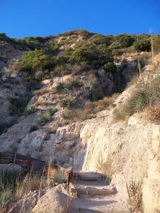
At the end of the Mesquite trail, the boardwalk ended, and I began to walk on sand. The canyon walls rose steeply on both sides, with a green thick lane of greenery running down the middle. This was the outlet for the oasis at Big Morongo. Didn't see any running water, but the abundant cottonwood told me that water couldn't be that far beneath the surface.

After 1/3 of a mile, I reached a wooden gate with a zig-zag opening. There, the West Canyon Trail headed to the right (west). The Canyon Trail continued straight ahead.

Rather shortly, I came to a .5 mile marker. "Well, that's convenient," I thought to myself. I figured I'd head to the one mile point, then turn around.

The .5 mile, by the way, certainly referred to the "distance on dirt," which started where the Mesquite Trail ended.

The trail here was dense, with flowering plants close in on both sides, and bees pollinating on both sides, as well. Still, I always figure they've busy doing their work and wouldn't have time to mess with the big oaf walking past them. And, sure enough, they left me alone and I emerged on the other side unstung.

Meanwhile, the next half-mile, turned out to be much longer than expected. I was sure I had gone well over that distance with no sign in sight. At last, with the water supply approaching 1/2 depleted and me feeling the effects of walking in 100 degree heat (though with ample shaded areas along the way), I decided, "OK, at that next rise, I'm turning around, sign or no sign."

When I got to that rise, there WAS a sign: 1.5 miles! Don't know if the 1.0 mile sign has fallen or never was, but what was explained was why that last 1/2 mile seemed so long!

Good turn-around point, too. It was on a bit of a rise, and gave a good view down the canyon, and at the hills beyond. You could also look back where you came. And with my having covered 1.5 miles, already, I was guaranteed of covering my arbitrary minimum of 3 miles for the day's hike to count towards my potential 100 for the year.

About 1/2 mile back, the front 4 inches or so of my boot sole separated from the rest of the boot.

Crap. That was weird. Didn't feel like I was even putting any stress on the seam when it happened, either.

Still, I knew I only had about a mile more to go on flat and mostly sandy earth, before the boardwalk would begin. Then, even with no boot, I'd be fine.

Walked carefully, if somewhat slowly, and kept taking lots of pictures. Plenty of little cone flowers and little blue damsel flies to photograph.

Also amusing to see was the large cougar-thing on the roof of the educational building.

Made it back to the car with my boot sole still hanging on.

Drove on, further east on CA-62, through Yucca Valley, and on, to the town of Joshua Tree. Once there, just before Park Blvd, I stopped for dinner, before continuing on to my astronomy destination. I also stopped for another, short hike, later that afternoon. That'll be the next post.

For this post, I can report 4 1/3 miles for the hike. Easy enough for kids, especially if you stick to the boardwalk areas, and as long as you're cognizant of the heat (if you're visiting in the summer). Keep the kids hydrated (they dehydrate faster than adults, and don't always know to drink, or to slow down in the heat). Also, keep them from messing with the bees!

Dogs are not permitted on these trails.

Monday, July 23, 2012

Hike 2012.047B -- Smith Ridge

Hiked Tuesday, July 17, immedi-ately after my hike to Lewis Falls. See that post for directions to trail head.

From Lewis Falls, I hopped in my car and continued up CA-39, staying straight where the road to Crystal Lake comes in from the north. I parked in the large clearing near mile marker 38.4.

From there, I walked around the "Road Closed" gate, and on up CA-39. I think I'd like to take my bike up here one day and explore more of CA-39, but, right now, the bike I have access to won't fit in my car, and don't want to buy a bike rack. This standoff will have to end one day, but it has not yet come to pass.

Today, on foot, my goal was "Smith Ridge." I don't see that name on a map, but it would make sense. It's the dirt road I got on to when I walked from Smith Saddle north (rather than south, to Smith Mountain).

The trip from the south to the top of Smith Ridge was a steep climb, much tougher than summitting Smith Mountain. On that hike, I walked north a bit past the high point and could see that this jeep trail would eventually merge with CA-39. Clearly, it would be easier to reach the high point from the north rather than the south.

On this day, having done my little hike to Lewis Falls, but needing additional mileage to make the day count as a hike, I settled on answering the question of how this hike from the north to Smith Ridge might go.

From the end of the road, it turns out to be just about exactly one mile to the meeting with the Smith Ridge jeep trail. Buckwheat grew densely along the south shoulder of the highway. Meanwhile, along the north shoulder, much of the way was semi-riparian in nature. A small seep of water came off the mountains to the north, and ran as a rivulet for well over half of the distance between points A and B, before disappearing down a drainage culvert.

Once at the ridge and road, I was disap-pointed to see no sign designat-ing a name or number to this road. But, about 100 yards into the hike, I passed a partially embedded water tank with the word, "SMITH" painted on the top. Hence, I deduced this ridge to be "Smith Ridge."

Incident-ally, there's also a "lower" jeep trail that splits off from the one that runs along the ridgeline. I walked on part of that one during my hike up from Smith Saddle. It's not as heavily used and more overgrown and less stable than the ridge route, though it does give a better view south than you can see from the top of the ridge.

That's getting ahead a bit. From the CA-39, the ridge jeep trail undulates up and down, though generally does gain altitude as it makes its way to a small flat area before dropping over in thicker brush towards Smith Saddle. Nice views in all directions the whole way, though, it being evening by the time I got here, the views to the southwest were pretty much hazed and glared out.

I'd guestimate (by feelinng and looking at a map) that it's about 3/4 of a mile along the ridge, from the highway to the last flat area before the brush and steepness make further progress doubtful. There's a "SMITH" Caltrans surveyor monument embedded at this end. Weather station equipment is a bit lower, in a less accessible location (No doubt by design).

Overall, this hike is among the easier hikes in my collection. Yes, there's some altitude gain involved getting from your car to the ridge, and some gain and loss there. But, over all, I'd estimate no more than 150 feet of vertical gain. It's mostly level, and pretty impossible to get loss. Definitely dog- or kid-friendly, if they're inclined to want to walk outdoors. Not much shade, though, a hat or sunscreen may be a consideration. An Adventure Pass is required.

Sunday, July 22, 2012

Hike 2012.047A -- Lewis Falls, Angeles National Forest

Hiked Tuesday, July 17. This was actually two separate hikes, but the first one was not long enough to qualify as a hike by itself. It's only about 1 mile roundtrip to Lewis Falls. After I finished Lewis Falls, I hopped in the car and drove up to the end of CA-39, then walked up and along "Smith Ridge." That hike was probably about 3.5 miles by itself, so figure about 4.5 miles for the day. That'll be Hike 2012.047B.

First, Lewis Falls. I last hiked there just over a year ago. To get to the trail head, exit the Foothill Freeway (I-210) at Azusa Avenue and head north. As you approach the mouth of San Gabriel Canyon (about two miles from the freeway), you'll note the first of many white mileage marker signs. I don't remember exactly, but I think the smallest one I remember seeing around here is something over 14 miles. So figure on driving about 21 miles total from the freeway, past the two large dams, pass the turnoff for the East Fork, pass the OHV area, pass the West Fork Trailhead, pass Coldwater Campground, past the turnout for the Upper Bear Creek trail. Just at mile marker 34.54, you'll see a large, rusted sand dispenser that's been there for at least a year, even though it looks like Caltrans is done working the area for now.

Right after the sand dispenser, the road makes a sharp right, then a hairpin turn to the left. At the apex of that turn is a small, yellow "No Fires" sign, and room for 2 or 3 cars to park. There are also small turnouts on the opposite side of the road, both before and after the turn.

The trail is not otherwise marked.

Your walk takes you pass the No Fires sign. Resist the temptation to immediately drop to the creek level. Instead, stay on the trail. After about 60 yards, you'll pass directly adjacent to a large evergreen, which I assume to be a red cedar. It won't have needles, but, instead, it has almost fan-shaped branch tips. The bark is thick and slightly reddish, too. It's also the first tall evergreen you'll pass, so it should be easy to recognize.

As soon as you pass this tree, the trail you want to follow will be zipping off to the right, at a 90 degree angle from your original direction of travel. You go up and around a cabin with the numbers "123" on it, and in front of other cabins. You'll soon also be crossing the foundations and yards of cabins that are no longer there, with stone steps to guide you in spots.

Most of the trail along this section is well-defined, and walkable without too much ducking. It seems a lot of work has been put in to clearing this trail over the past year.

After about 1/2 mile, the trail drops down to the creek level. My recollection is I only crossed the creek once or twice. At creek crossings, it is clear that plenty of dead wood still lies atop and across the stream. The good news is that the fallen timber sometimes provides a clear path across the water.

This time, when I approached where I knew the falls would be, I stayed on the left side of the stream. It did require a little ducking and stretching, but it was not too hard to get to the pool level.

With the water running lower than last year, it was easy to get from the left side of the pool to the right side of the pool. From there, I could take a more or less face-on shot of the waterfall, which is at the top of this post. I also took a number of "profile" shots. For some of those, I stepped back 10 or 20 yards from the pool and shot near a patch of columbine, which was exactly where it was the last time I was here.

I also shot some close ups of the flowers, with the falling water as an out-of-focus backdrop.

Short hike, though with an impressive pay-off. Also, on the weekday afternoon I went, I had the trail to myself. That would never happen at Eaton or Sturtevant. Still, you'll need at least average dexterity to navigate the fallen timber. Because of the drive involved, you'll probably also want to combine a visit to this falls with another short to medium hike elsewhere in the canyon

Thursday, July 19, 2012

Hike 2012.046 -- Temescal Gateway Park to Will Rogers State Historic Park, and Inspiration Point

Hiked Saturday, July 14.

After my Temescal Canyon and Ridge hike and lunch, I headed off for hike two of the day, from Temescal Gateway Park to Will Rogers State Historic Park. After heading north, past the snack shop again, the loop road was again before me. This time, I took the right side of the loop, where the sign pointed you if you wanted to go to Will Rogers.

It's 2.1 miles one way to Will Rogers, and it's a tough 2.1 miles, with a very substantial and steep altitude gain near the start. You're practically climbing stairs in places.

The photo-copied map from the Santa Monica Mountains Conservan-cy shows you climbing from 375 feet above sea level at the trail head to 710 feet above sea level in the first roughly 1/2 mile. After topping out at 775 feet above sea level, your trail provides views to the south, and occasional open views up both Rivas and Temescal Canyons. Then you descend a switch-backed portion of trail, which drops you down into Rivas Canyon.

Rivas Canyon has a dense canopy of flora. It's also largely overgrown by ivy. Reminds me a bit of Sturdevent Canyon, though with more ivy and less water.

The remainder of your hike heads down the canyon, where you lose 150 feet over about a mile, then climb back up along the back of a ridge, gaining 125 feet as you pass near several private homes. Cross a grassy field, with another private home on your right, and the road heading into Will Rogers State Historic Park also on your right. You'll see the entrance station down there, too.

I continued along this trail, past an unsigned trail that headed steeply up the hill on my left. That would be the "bypass" trail I'd take a little later.

First, I headed down towards the developed section of the park, all set to splurge a few bucks on something cold to drink.

Didn't find that. I did find flush toilets and a drinking fountain. Also, a polo field, where Pacific Palisades was taking on Beverly Hills. Yeah, I'd say they'd be part of the 1%. ;D

I watched about ten minutes of play as I let the coastal breeze cool me off, even as I sat in the sun (though with my floppy hat shading my face and shoulders). Then I headed back to the water fountain, drank some more, and filled my empty water bottle.

Climbed back up the stairs that go from the visitor center back to the trail, and eventually made it back to the bypass trail (Actually, I took a detour that probably added a mile or so to my total distance for the day). Headed up a few hundred yards, where it rejoins the sweeping fire road that is the main Inspiration Point loop. Turned right. Soon came to another sign. It said .2 miles to Inspiration Point if I went straight, or .4 miles if I turned right. Given that I had already walked plenty, I took the shorter way.

That way passes north of Inspiration Point, and approaches from the south. The coastal fog still hid the ocean, and even threatened to flow over the polo field.

Snapped some pictures, then headed back the way I came.

Along the way, I passed a trail that came in from the northwest. I also saw a kiosk, so I walked a few hundred yards out of my way to look at the map. Chatted with a middle-aged guy about hiking in the area. I also confirmed that this would be where the Backbone trail would make its way from near Inspiration Point, west and north, through Topanga State Park. If not willing to go that far, the middle-aged guy told me that Lone Pine was a common turn-around destination for day hikers. I also noted that one could make a loop of this section of Backbone with the Rustic Canyon trail.

Finally started my return trip, having taken about a ten minute break at the kiosk, after another five minute break at the top of Inspiration Point. Yet, I was soon chatting with a couple of other hikers, a younger (than me) couple making their way around the loop. Had to cut that chat short, though, as I soon reached the cut-off trail.

Soon enough, I was back, over looking the road that enters Will Rogers park. Then back along the trail towards Rivas Canyon, and, beyond, the connector trail.

As I headed back, down into Rivas Canyon, I passed another couple. They were wearing sandals. I had seen them earlier along a stretch of the loop trail (they were heading down the main trail, far to my left, when I reached the main trail from the cut-off trail and made my right). On the Inspiration Point loop, they were under-shod, but going down the steeper, narrower, rockier Rivas Trail seemed a little silly. Don't know how far they went that way, but I hope not too much further.

Approximately 5.5 miles on this hike. Substantial and steep trail heading to Will Rogers. Easier heading back. No major drop-offs. Dogs are permitted on this trail, unlike most in the state parks.